Themes & Projects
Browse
All Items
Divisions
Subjects
My Collections
Themes & Projects
About
Advanced Search
Help us improve our site.
Please take our survey
!
Digital Collections User Survey
×
Loading…
Home
Filtered search
FILTER SEARCH
Exclude Born Digital Content
DATE RANGE
to
Limit
ONLINE FORMAT
Image
30
Text
3
ORIGINAL FORMAT
maps
19
financial records
3
ORIGINAL FORMAT
×
ORIGINAL FORMAT
COUNT
maps
19
financial records
3
LOCATION
Bladen County (N.C.)
3
Fear, Cape (N.C.)
2
North Carolina
2
Craven County (N.C.)
1
Maryland
1
South Carolina
1
Virginia
1
LOCATION
×
LOCATION
COUNT
Bladen County (N.C.)
3
Fear, Cape (N.C.)
2
North Carolina
2
Craven County (N.C.)
1
Maryland
1
South Carolina
1
Virginia
1
THEME/PROJECT
North Carolina Maps
Military History
6
Military History: Marines
5
Early American History
1
Military History: Civil War
1
Special Collections Staff Picks
1
THEME/PROJECT
×
THEME/PROJECT
COUNT
North Carolina Maps
33
Military History
6
Military History: Marines
5
Early American History
1
Military History: Civil War
1
Special Collections Staff Picks
1
SUBJECT
Deeds--North Carolina--Bladen County
3
Land tenure--North Carolina--Bladen County
3
Smith, Thomas
3
Cape Fear River (N.C.)--Maps
2
Cape Fear River (N.C.)--Navigation
2
Fear, Cape (N.C.)--Maps
2
Nautical charts--North Carolina--Cape Fear River
2
More
SUBJECT
×
SUBJECT
COUNT
Deeds--North Carolina--Bladen County
3
Land tenure--North Carolina--Bladen County
3
Smith, Thomas
3
Cape Fear River (N.C.)--Maps
2
Cape Fear River (N.C.)--Navigation
2
Fear, Cape (N.C.)--Maps
2
Nautical charts--North Carolina--Cape Fear River
2
Battlefields--North Carolina--Maps
1
Craven County (N.C.)--Maps
1
Fortification--North Carolina--Maps
1
Fryingpan Shoals (N.C.)--Maps
1
Fryingpan Shoals (N.C.)--Navigation
1
Landowners--North Carolina--Craven County
1
Marine Corps Air Station Cherry Point (N.C.)--Maps
1
Maryland--Maps--Early works to 1800
1
Nautical charts--North Carolina--Fryingpan Shoals
1
North Carolina--History--Civil War, 1861-1865
1
North Carolina--Maps--Early works to 1800
1
Real property--North Carolina--Craven County--Maps
1
South Carolina--Maps--Early works to 1800
1
Spaight, Richard Dobbs, 1758-1802
1
United States--History--Civil War, 1861-1865--Campaigns
1
Virginia--Maps--Early works to 1800
1
White, William, -1811
1
DIVISION
East Carolina Manuscript Collection
15
Joyner NC Maps
2
Special Collections Maps
1
DIVISION
×
DIVISION
COUNT
East Carolina Manuscript Collection
15
Joyner NC Maps
2
Special Collections Maps
1
Filters
Search Results
33 results found for:
Bonds—Confederate States of America
Theme/Project:
North Carolina Maps
Sort by:
Relevance
Date Digitized
Date Created
View all
North Carolina Maps
material.
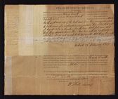
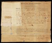
Thomas Smith. Deed no. 3810
Thomas Smith. Deed no. 2545
Map showing gaging stations and undeveloped water-...
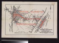
Map showing suburban developments along the lines ...
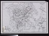
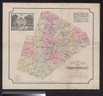
Shaffer's map of Wake County, N.C.
Eastern Craven County and Carteret County North Ca...
Eastern Craven County North Carolina Highway Map (...
Eastern Craven County and Carteret County, North C...
Eastern Craven County North Carolina Highway Map (...
Eastern part of Jackson County E.W. Myers.
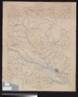
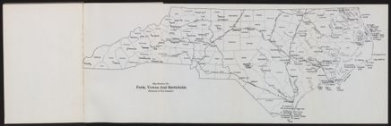
Map showing the forts, towns and battlefields ment...
Ownership map of proposed Cherry Point Marine Avia...
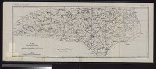
Map of North Carolina by W.C. Kerr ; assisted by W...
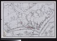
Preliminary chart of lower part of Cape Fear River...
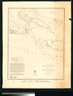
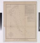
Sketch of Frying-Pan Shoals
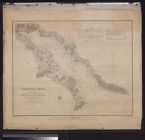
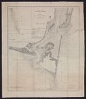
Entrances to Cape Fear River
Partie meridionale de la Louisiane, avec la Florid...
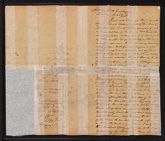
Thomas Smith. Deed for 240 acres of land
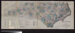
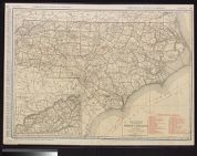
Standard map of North Carolina
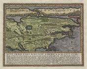
Virginiae partis australis, et Floridae partis ori...
Preliminary sketch of Beaufort Harbor, North Carol...
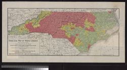
Stock law map of North Carolina compiled from data...
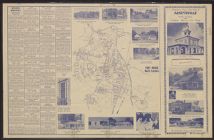
Presenting your city map of Fayetteville, North Ca...
Pasquotank River from a trigonometrical survey und...
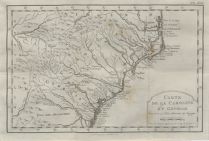
Carte de la Caroline et Georgie pour servir a l'hi...
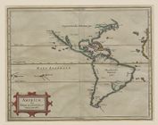
Americæ sive Indiæ occidentalis tabula generalis
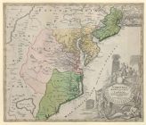
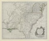
Virginia, Marylandia et Carolina in America Septen...
Novi orbis pars borealis, America scilicet complec...
A new map of Carolina
Topography, state of North Carolina Chocowinity qu...
Carteret County North Carolina State Highway and P...
Lenoir County North Carolina State Highway and Pub...
Map of the British empire in America with the Fren...


![Virginiae partis australis, et Floridae partis orientalis, interjacentiumq[ue] regionum nova descriptio](https://digital.lib.ecu.edu/encore\ncgre000\00000011\00010394\00010394.jpg)